Everything seems to be a bit more difficult till we humans just think of its harms and consequences. But once we begin treading on the challenging paths to achieve something, it becomes adventurous, unique and simply easier.
When the world head of Climate change dangers first, we opened our intellects using the doorways of many possibilities, maybe it’s just a recalcitrant theory, what may happen maybe we have time.
But all these doubts vanished once we started witnessing grave impacts of this evil. The story went on and now, we see its mischievous face in every aspect and sphere of life.
Nothing is alive with a little tinge of Climate change in it.
Time and again, we have reminded ourselves of our neglected Oceans: though 13 percent of land is protected globally, just a less than 2 percent of entire ocean is protected as a “no-take” reserve.
Similar is the story of lack of reliable techniques to understand our worldly waters and this makes us truly vulnerable.
Because while we grow passionate about land as a territory, there is barely any regards for vast Oceans.
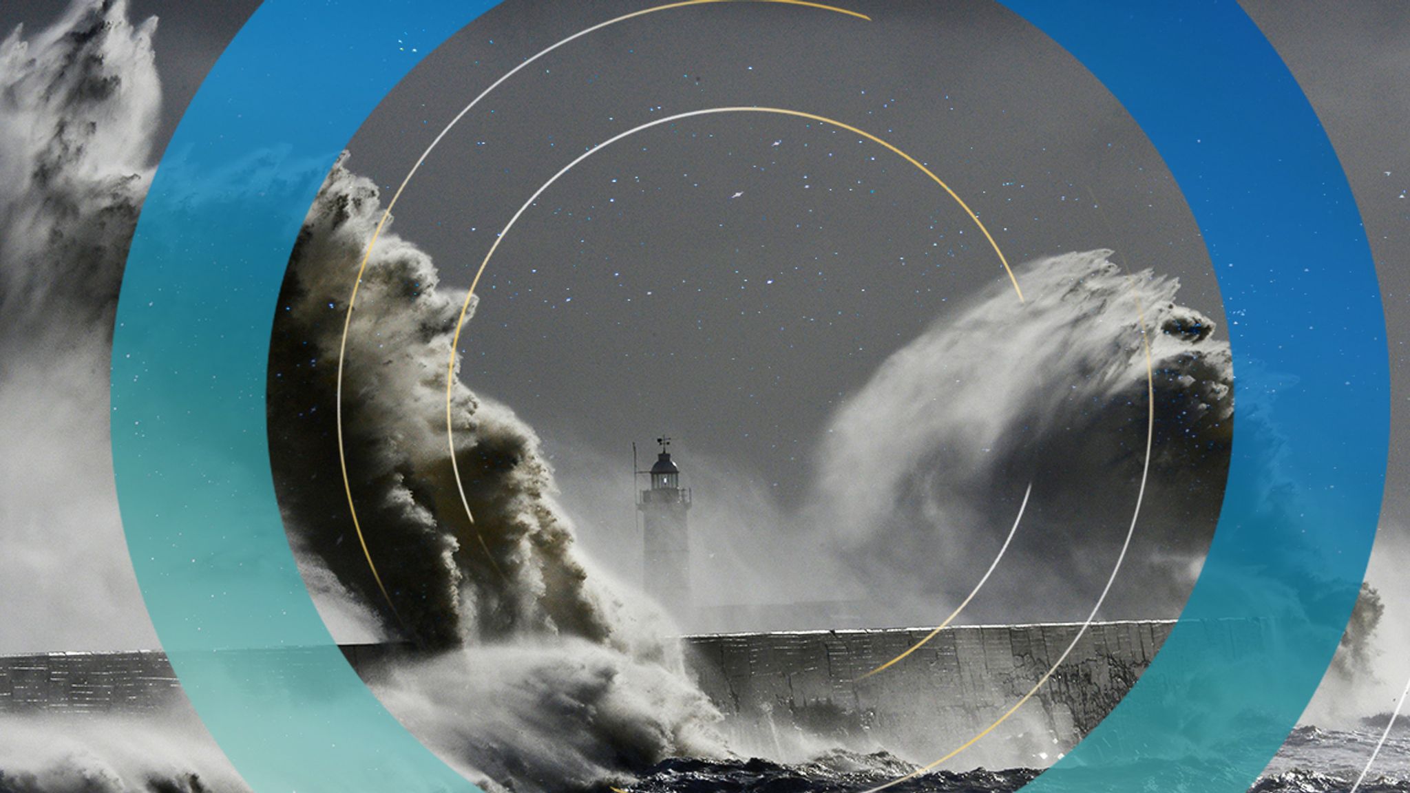
These greatest sinks of Carbon are absorbing more heat than we can imagine or assess and so is depicted in rising Sea levels.

In this Decade of Ocean Science for Sustainable Development 2021-30, what lies ahead is only to be mitigated and protected to lessen the deadly impacts on human lives and livelihoods.
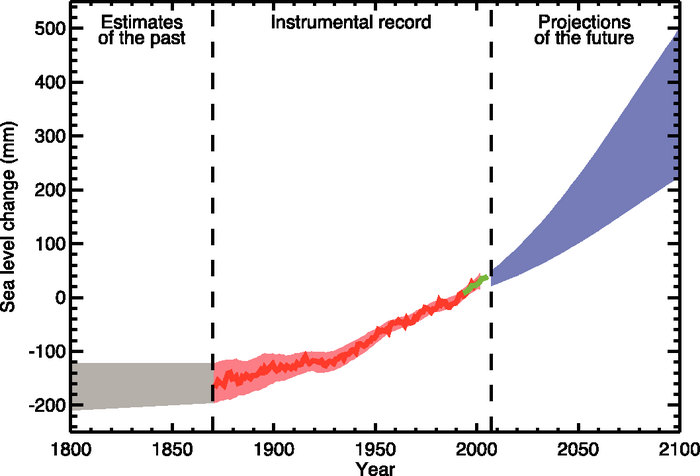
Understanding this, National Aeronautics and Space Administration (NASA) has invented a visualisation tool that collates information regarding the future sea level in the world.
The tool available for public NASA’s Sea Level Portal provides a well projected picture inferred from the IPCC’s Sixth Assessment Report 2021.
NASA’s program Scientist explains: “What’s new here is a tool that we are providing to the community, to distribute the latest climate knowledge produced by the IPCC and NASA scientists in an accessible and user-friendly way while maintaining scientific integrity.”
How can the tool help in decelerating a humanitarian crisis?
It helps to assess the current danger better in pictographic realizations, increase the climate resilience and it’s understanding along with managing future dangers too.
Global and regional sea level changes are projected from 2020 to 2150 along with flexibility in scenarios. Such a mode can help assess and quantify the processes driving climate change in specific regions.
The countries’ governments can use it to help their large coastal populations, infrastructure and dependent economies which seem to be more likely impacted by the sea level rise, like maybe submerging coasts.
These depictions include various socio-economic factors as well as a hopeful low-emissions future (where the world would be a nice place with its greenhouse gas emissions reduced, thereby debilitating the climate-driven sea level change).
It also enables to envisage a business-as-usual trajectory for emissions on their expected track and an accelerated emissions case too.
With IPCC’s recent revelations on the run, the science has provided the collated information. All we need to do is follow, respect Nature and determining such abrupt Climatic projections can help tackle the risks.