Google is now adding safety features including hurricane forecast cones, earthquake shakemaps, flood forecasts, and crisis navigation warnings. Google will be launching a new navigation warning system as part of Google Maps to keep you informed and safe during such a crisis.
The app already allows you to see basic information about a crisis, like what’s happening, provides emergency phone numbers and Twitter updates from authorities. But with this new update, now you’ll be able to get more visual information. For example, during a hurricane, you’ll be able to see the storm’s trajectory and also get information about what to do. In an earthquake, you’ll see a graphic that tells you the epicenter and magnitude. In a flood, you’ll see where the water is likely headed.
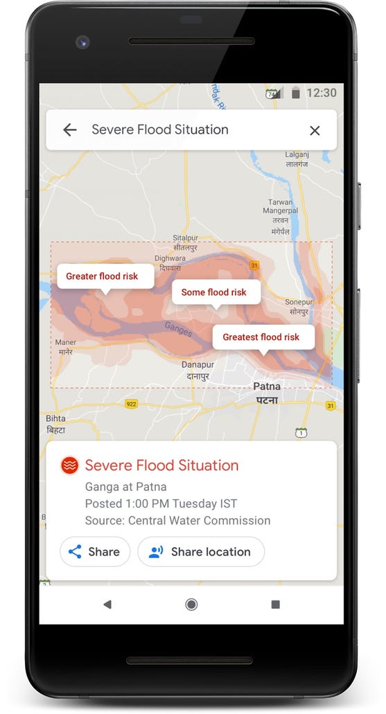
During such chaos, you can share your location with family and friends and within Google Maps turn on a traffic layer to visualize suspected road closures. You can also report such closures to others and through a crisis information card, tap on a share button to keep loved ones informed and to direct them in turn to Google Maps where they, too, can view a summary, get emergency contact information, and so on.
You’ll see a prominent alert if we think your route may be affected by crisis activity— and when possible, we’ll do our best to route you away from the disrupted area,” Stulberg wrote.